Recently, I was working on a patron request that involved photographing multiple foldout maps from a range of books. Foldouts in books are always tricky, and involve both conservation and photographic issues.
I like to work with a “First, do no harm” mentality when dealing with fragile materials; if I have any concern that they might be damaged during digitization, I head directly over to our Conservator. In fact, there were two books in this request that I did not photograph, because their foldout maps where either too fragile or too brittle to unfold (I find paper that’s been folded for over a century or so likes to stay folded).
Once I know that I won’t damage the foldout, the next challenge is to photograph it. This means supporting the entire foldout (usually with foam sheets) and making sure it’s as flat as it can safely get. From there it’s a dance of sorts to make sure the entire object is evenly lit (tough when you have creases that create shadows) AND that the entire expanse of the foldout is in focus (especially difficult when it doesn’t unfold completely flat).
We do sometimes run into foldouts that require photographing in multiple steps and stitching the pieces together. In these cases we are very careful to replicate the circumstances of each image exactly (i.e. with lighting and focus), and stitch the image together in Photoshop without changing the object in any way.

This image comes from Chisholm’s All Round Route and Panoramic Guide of the St. Lawrence: the Hudson River; Saratoga; Trenton Falls; Niagara … the White Mountains; Portland; Boston; New York, published in 1874. The book itself is five inches wide by 7.5 inches tall – the map is about 7.25 inches wide and almost 13 feet long. The vertical image on the left shows the length of the map, shot as nine separate images and stitched together very carefully in Photoshop.
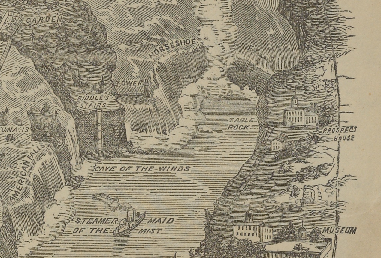
Because the map was actually quite flat, I was able to shoot directly on our reprographic stand. Our camera is very high resolution (80 megapixels), as you can see with this detail shot, taken as a screen shot when the image was enlarged to 100%.
This map happens to be of the Niagara River, so we see Horseshoe Falls and even “The Maid of the Mist.” The entire map is this detailed, and it’s pretty amazing to see such a large map fold out of such a relatively small volume.
The map did photograph easily, but parts of the map had already torn (as visible in the long image, where you see some small breaks in the map). This went straight to Conservation after photography. Also visible are the color targets we include in each shot (I only included six of the nine I used; once for each shot). These ensure that our exposure, color balance and resolution are set properly to ensure an archival file viable for many future uses.

