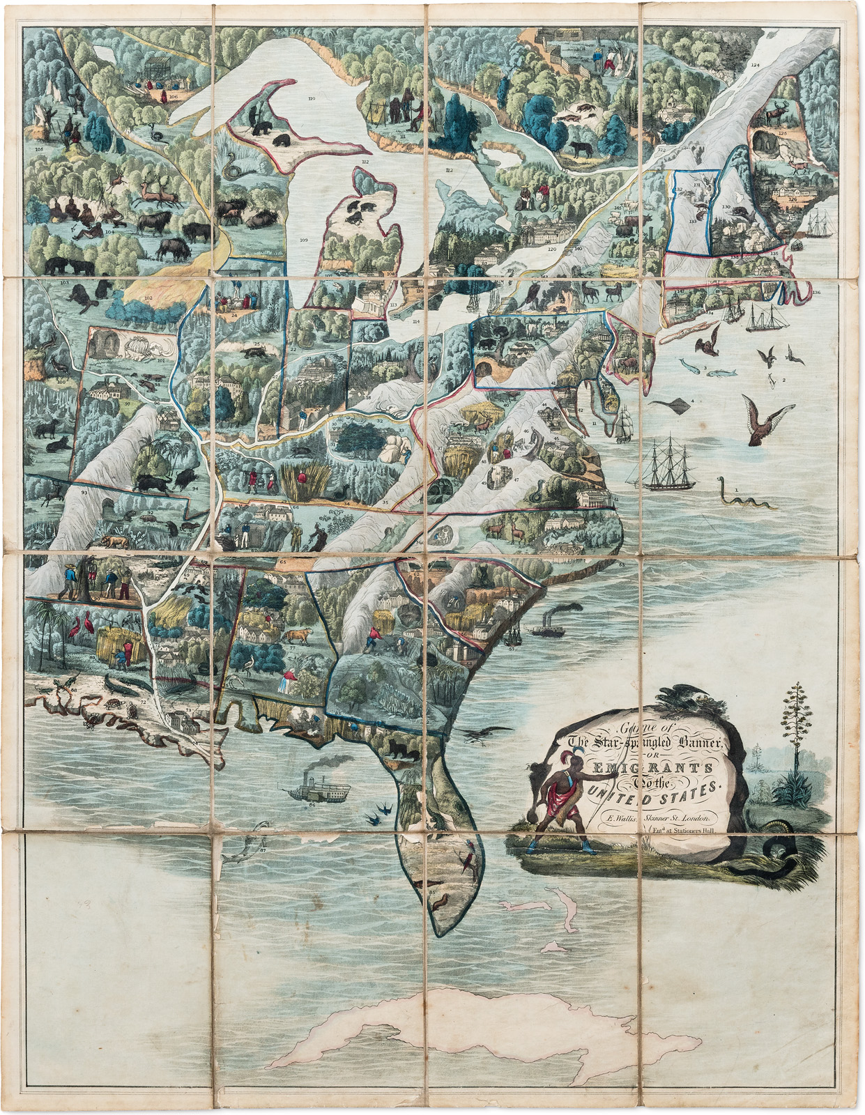
1830, Edward Wallis, London, England.
This game was designed to teach British children about the United States, and it may be the earliest example that shows a map of the region. Its author gave an extensive commentary in the accompanying booklet, seizing the opportunity to decry slavery (which would be abolished in Britain in 1833). The board depicts enslaved labor and a lynching, described as “an odious practice…in the states that are at a great distance from the general government.”
Native American camps are shown throughout the wilderness, as well as sites of early archaeological interest marked by mammoth skeletons. This is a vision of North America through the eyes of the British, after they had lost official colonial links with America but continued to depend on the enterprise as a whole.
Gift of Ellen Liman ‘57